Arabic natural‑language map search
Ask the map in Arabic and get the answer straight from the data.
An example I built: gischatYou don't need a GPU to start: your current servers and open-source models are enough, and you add a GPU when you need it.
The idea
I built it at home as a side project, for a problem every GIS department knows: other departments need something from the spatial data, so they send an email or a ticket and wait.
With gischat, departments query the data themselves, in their own language. Later, departments at a government entity used a private version of it, running inside the entity on its own data.
How it works
- 1
Takes Shapefiles, converts them and imports them into PostGIS with Node.js.
- 2
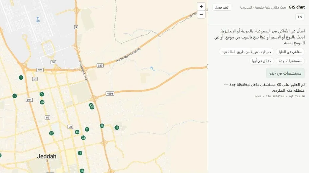
The user types a question in Arabic or English, such as "hospitals in Jeddah."
- 3
The model turns the question into a structured request (JSON), and the code picks a ready-made query for PostGIS to run, so the model never writes SQL. The home version runs Qwen 3.8 27B on a GPU; the production version runs a MoE model on the CPU alone, because it answers faster.
- 4
Results appear numbered on the map and in a table, and everything runs on local machines.
- 5
In production, without a GPU, the context window is small, so it resets every 5 questions to keep answers fast.
"Hospitals in Jeddah"
Open-source model
Template picked by code
Spatial data
Convert and import
Runs the query
20 to 60 seconds on average, no GPU